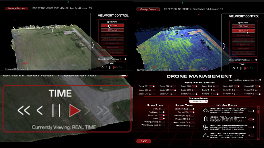
Multispectral 3D Maps and Data Visualization... in Real-Time
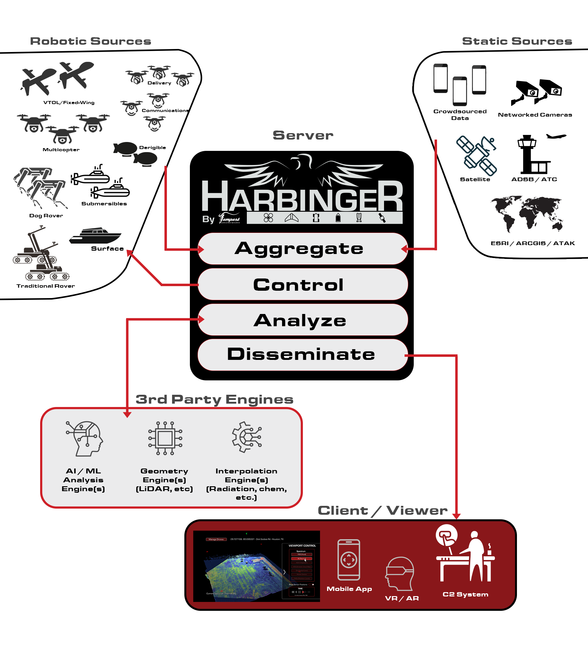
Harbinger™ is sensor, robot, and drone agnostic; and aggregates data from multiple sources while utilizing a video game engine to present that data in real-time.
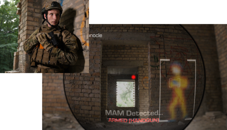
Because Harbinger™ data is presented using a game engine, the same visualizations can be viewed across multiple platforms simultaneously across the entire command chain… from multiple points of view. From augmented reality scopes/monocles to central C2 systems, Harbinger™ reduces time-to-decision to near-zero.
Watch the product tour to see our real-time maps in action…
How Does Harbinger™ Work?
The Harbinger™ platform consists of four main components working in concert to bring real-time intelligence across the entire command chain…
Harbinger™ Aggregate: A sensor agnostic rosetta stone which gathers all information from a plethora of sensors (from robots to satellites to security cameras and even crowdsourced data), and fuses that data into a common format.
Harbinger™ Control:A drone agnostic system which performs sUAS and UAS air traffic control, keeping aircraft and robots from dangerous situations and clearing airspace for manned aircraft in the area.
Harbinger™ Analyze: A system which communicates to virtually any AI / ML analysis tool(s); converting data from Aggregate into data the tool(s) can process, and then accepting processed data back into the Harbinger™ system.
Harbinger™ Disseminate: A client system designed on a video game engine with familiar controls, and platform agnostic (mobile, VR, AR, C2, Mac/PC/Linux, etc.) so that data is presented in context, and across the entire command chain of stakeholders… simultaneously – with little-to-no training for end users.
Multispectral, and Temporal
Harbinger™ organizes the sensors by type and platform, as well as the data by sensor and spectrum, giving users instant access to real-time intelligence in context, and with little-to-no training.
Furthermore, all data is cataloged. This gives the user the ability to “rewind” time. And because this is conducive to trend analysis; by plugging in partner AI, Harbinger™ can also predict futures such as chemical concentrations, plant health, and other environmental conditions.
Some of Harbinger™'s Use Cases
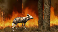
Wildfire Prevention: Tempest Harbinger™ can be deployed over large areas to persistently patrol using thermal imaging. When issues are identified, the battalion swarms the affected area to fully inform officials. By knowing early, and instantly what issues have started, officials are enabled to prevent those issues from ever becoming serious problems.
Military: From the Afghanistan airlift of 2021 to engagements in Ukraine and beyond; real-time intel for the entire command chain can show everything from troop movements to ambushes waiting around corners. And by using AI, even hidden threats are anticipated and actionable.
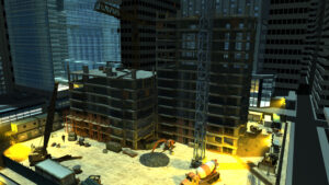
Construction: Real-time digital twins are not only possible with Harbinger, but they are practical. From temporal data cataloging locations of electric, rebar, and plumbing, to regular comparisons of materials used vs specifications, and even “rewinding” to see how accidents happen; Harbinger™ can save money and help avoid disasters.